NWS Boston EM Briefing: Impacts From Tropical Storm Fay

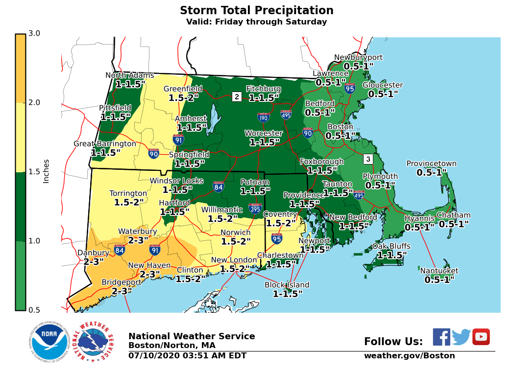
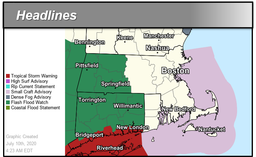
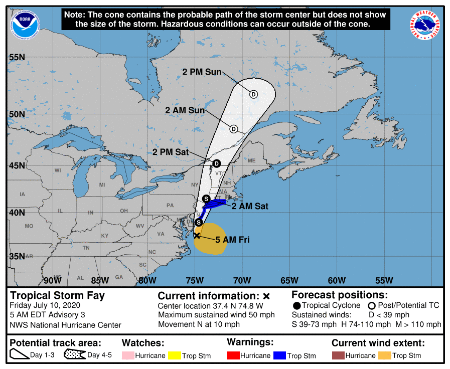
Good morning everyone, The following changes have been made to the forecast: *- Flash Flood Watch was taken down for eastern/central Massachusetts and Rhode Island. The best chance *of flooding issues may remain west of southern New England. Tropical Storm Fay is forecast to track north and pass over western Long Island and western Connecticut Saturday morning. The main concern from Fay in southern New England is the potential for flash flooding from heavy rainfall Friday night into Saturday in western MA and CT.* However, the best chance of flooding issues may remain west of southern New England. * Here are the key points regarding the main threats from Fay: *Flash Flooding:* We are most confident in the potential for heavy rainfall tonight in western MA and CT. Rainfall of 1 to 2 inches is likely with locally higher amounts. Minor urban flooding is possible but more significant urban and small stream flooding is possible depending on where the heaviest rain falls. *Wind:* It is likely that tropical storm force winds remain along the Connecticut coast. Prevailing wind direction should be from the south or southeast. *Rip Currents:* There is a moderate to high risk of dangerous rip currents and high surf Saturday, especially on south facing, ocean exposed beaches. *Severe Weather:* The overall severe weather threat is low, but an isolated tornado cannot be ruled out. The next email briefing will be sent this afternoon. If you have any questions or would like more information, don't hesitate to contact us via this email address, on NWSChat <https://nwschat.weather.gov/>, or by phone at 508.622.3280. Thanks, Bryce Williams and Hayden Frank National Weather Service Boston/Norton, MA 46 Commerce Way Norton, MA 02766 508.622.3280 Website <http://www.weather.gov/boston> | Facebook <http://www.facebook.com/NWSBoston> | Twitter <http://www.twitter.com/NWSBoston>
participants (1)
-
 BOX Operations - NOAA Service Account