[2022.01.05 AM] NWS Boston EM Briefing - Potential Winter Storm Very late Thursday night into Friday

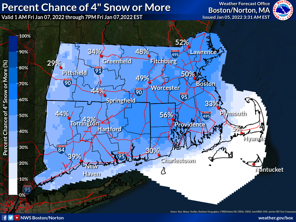
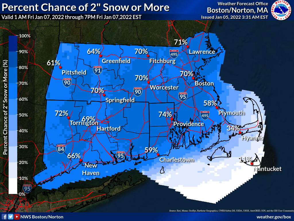
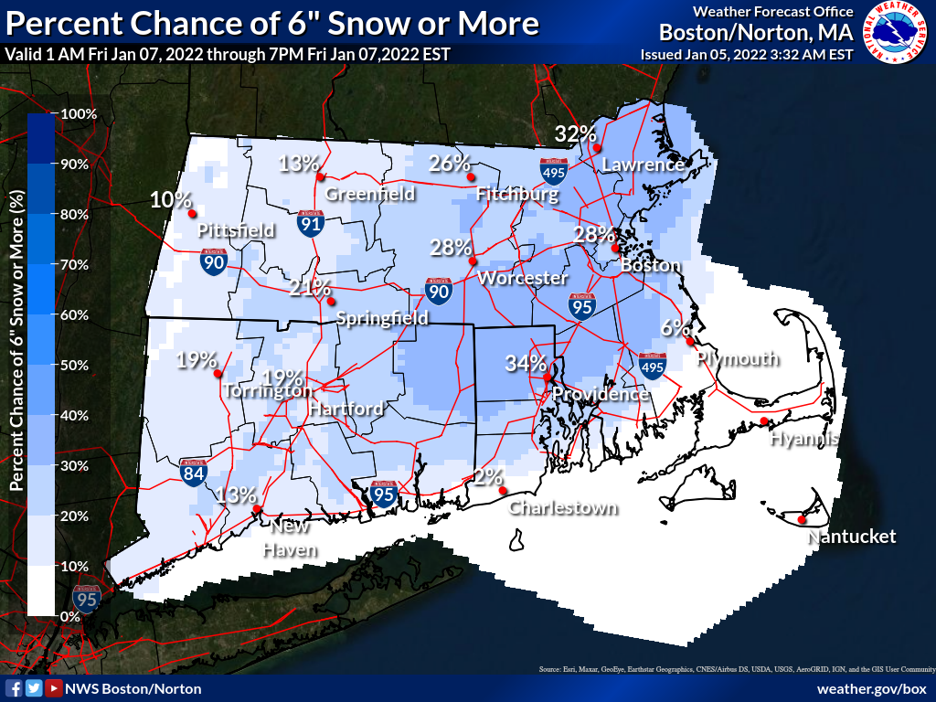
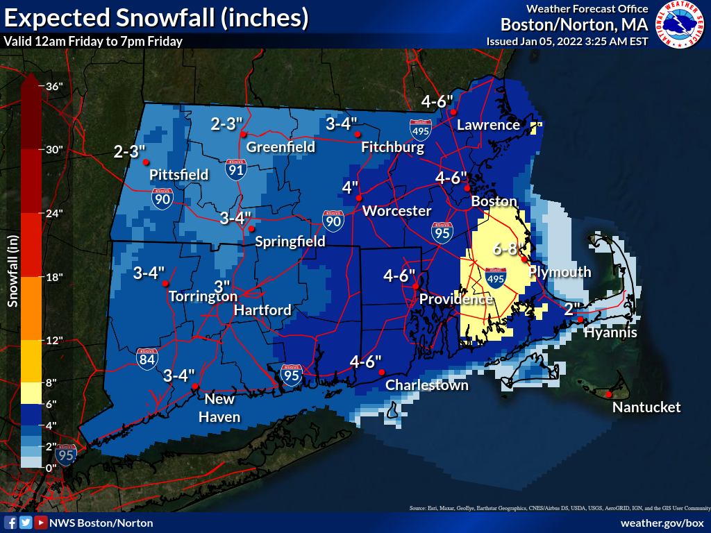
Good morning, Attached is a one page briefing and supporting graphics regarding a potential winter storm very late Thursday night into Friday morning. At this time we're expecting 3-6 inches of snow for eastern MA and RI and around 2-4 inches of snow for CT and the areas west of Worcester. The graphics included are the chances of snow exceeding 2, 4, and 6 inches as well as the official forecast. Please note that the area highlighting 6-8 inches in the official forecast map is expected to be closer to 6 inches than 8 inches. We'll provide an update later today when more information becomes available. Thank you, Rob Megnia and Matthew Belk If you have any questions or would like more information, don't hesitate to contact us via this email address, on NWSChat <https://nwschat.weather.gov/>, or at the following: National Weather Service Boston/Norton, MA 46 Commerce Way Norton, MA 02766 508.622.3280 Website <http://www.weather.gov/boston> | Facebook <http://www.facebook.com/NWSBoston> | Twitter <http://www.twitter.com/NWSBoston>
participants (1)
-
 BOX Operations - NOAA Service Account