[2022.01.04 PM UPDATE] NWS Boston EM Briefing - Light Icing Wed Morning; Potential Winter Storm Very Late Thursday Night into Friday

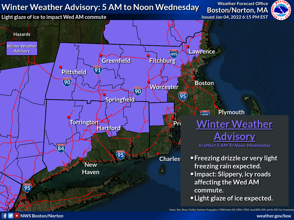
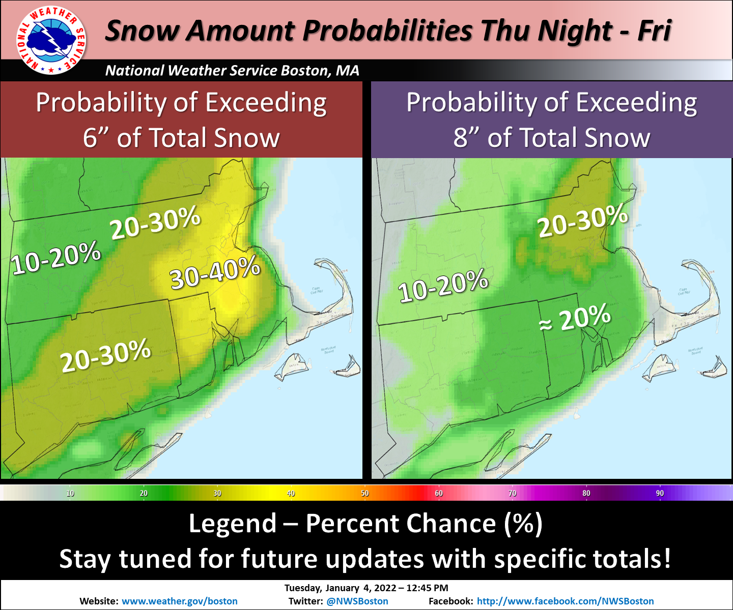
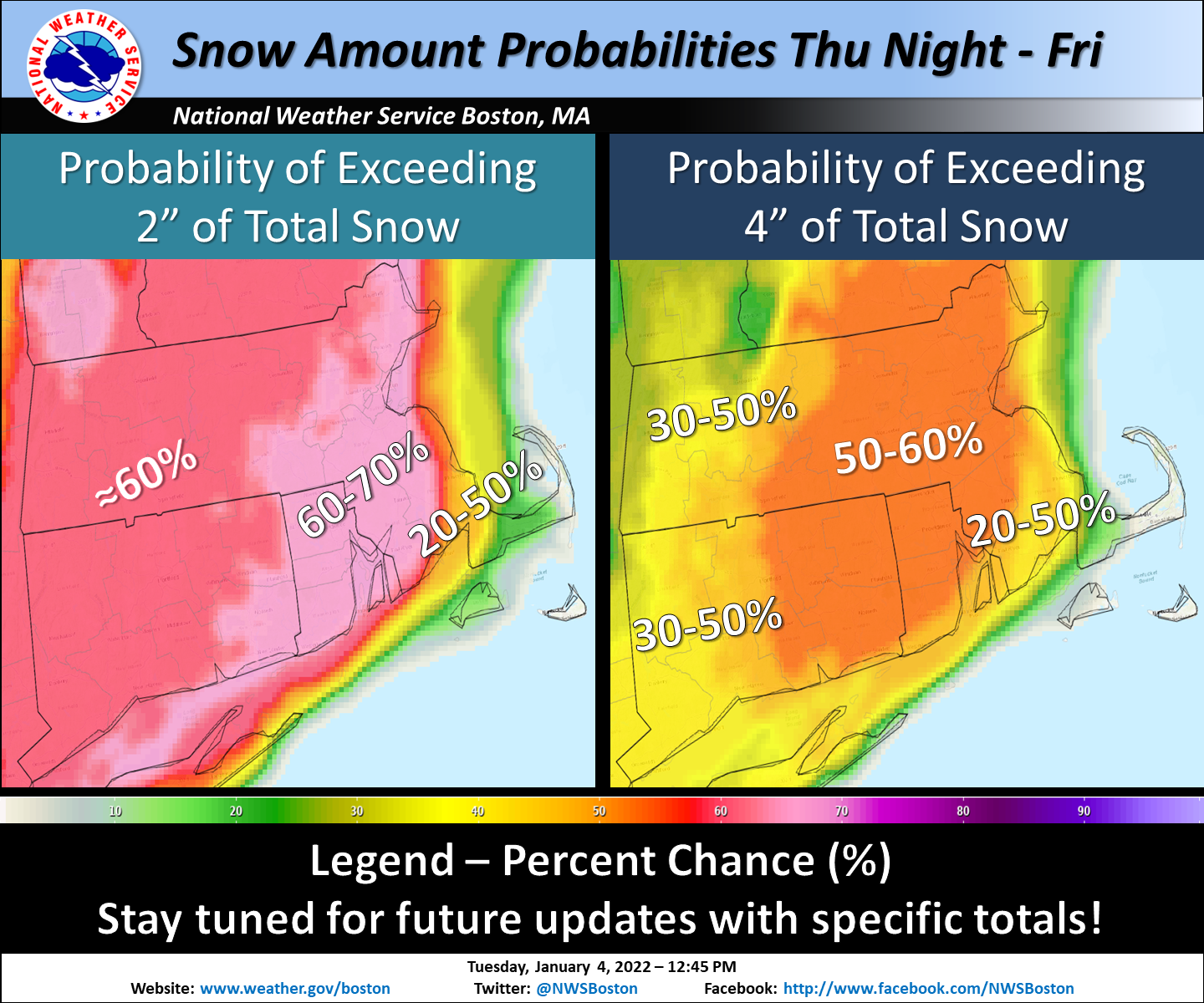
Good evening, We are sending an update to the briefing package sent at 130 PM Tuesday afternoon. This is to message a light icing event due to freezing rain and freezing drizzle with impacts to the Wednesday AM commute. We are also still monitoring the potential for a winter storm later Thursday night into Friday. *Light Icing To Impact Wednesday AM Commute* A period of light freezing rain or freezing drizzle is expected to begin early Wednesday morning. Slippery, icy roads are expected to cause impacts to the Wednesday morning commute for areas north and west of I-95. Temperatures are expected to warm above freezing by noon. Attached is a one page briefing & a graphic which includes the Winter Weather Advisory area. Unless there are significant changes to the forecast, *this will be the final briefing regarding this light icing event.* *Potential Winter Storm Late Thursday Night into Friday* We continue to monitor the potential for a winter storm to bring accumulating snow to Southern New England. No significant changes to what was briefed at 130 PM Tuesday have been made with this update. For completeness, we have attached the same graphics and one-page briefing that were sent earlier to this e-mail. Expect an update on this potential winter storm by *6 AM Wednesday.* Thank You! Meteorologists: Andrew Loconto and Hayden Frank If you have any questions or would like more information, don't hesitate to contact us via this email address, on NWSChat <https://nwschat.weather.gov/>, or at the following: National Weather Service Boston/Norton, MA 46 Commerce Way Norton, MA 02766 508.622.3280 Website <http://www.weather.gov/boston> | Facebook <http://www.facebook.com/NWSBoston> | Twitter <http://www.twitter.com/NWSBoston>
participants (1)
-
 BOX Operations - NOAA Service Account