[2020-07-19 AM] NWS Boston EM Briefing: Heat Advisory through Monday

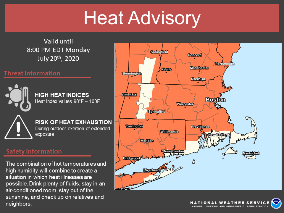
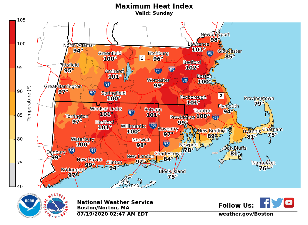
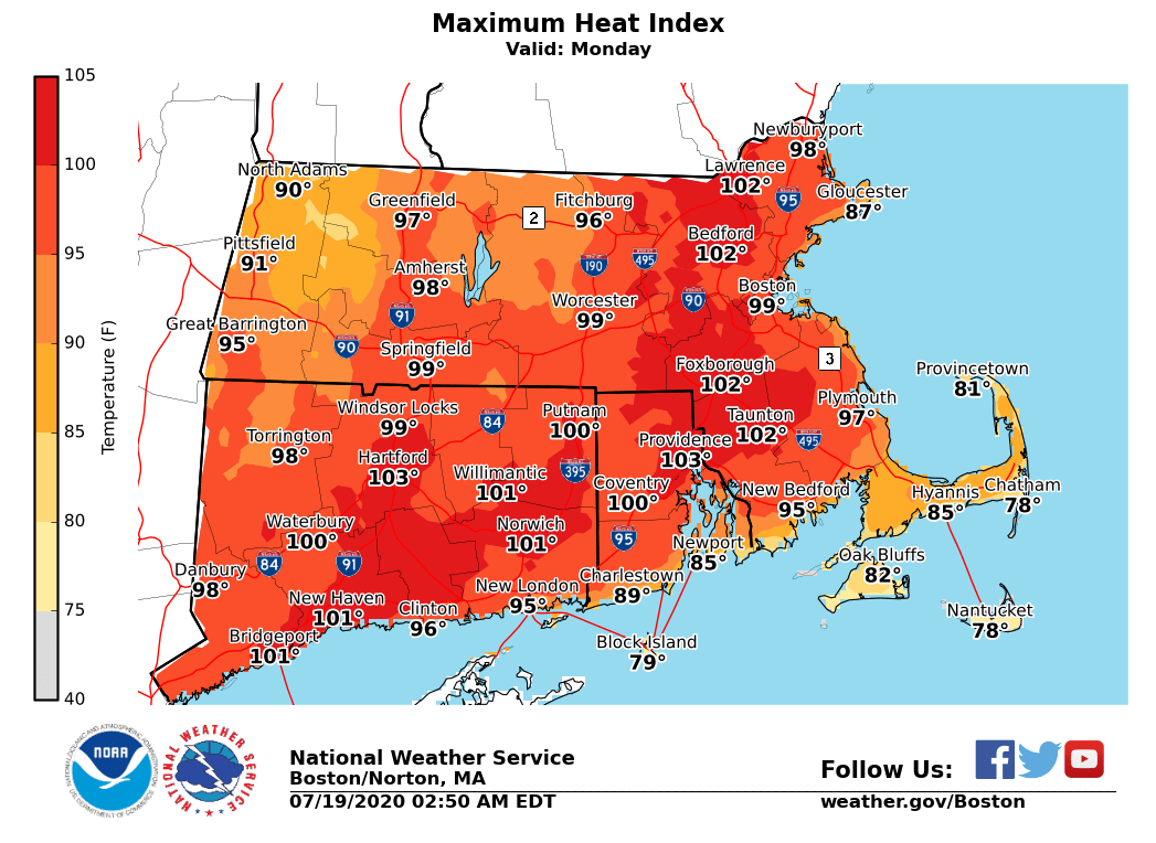
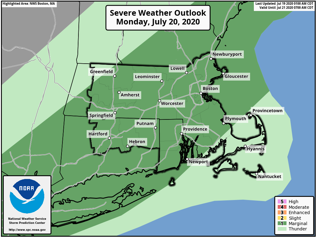
Good morning all, Here is the latest briefing regarding the heat advisory and potential for a few strong to severe storms on Monday. There is very little to no changes from the previous forecast. *Heat Advisory Sunday & Monday*: *What:* - Heat index of 98 to 103 degrees. *Where:* - Much of Massachusetts, Connecticut and Rhode Island, except the South Coast and the east slopes of the Berkshires. *When:* - Sunday and Monday. *Impacts:* - Heat illnesses may occur with prolonged strenuous activity outdoors. *Thunderstorm Risk Monday:* - A few strong thunderstorms possible Monday afternoon - Localized damaging wind gusts and heavy rainfall with the stronger storms - Heavy rainfall may produce localized flooding *Confidence: *Areal coverage of storms will likely be limited and it is possible most locations remain dry with just isolated storms. The best chance of thunderstorms may be along the I-95 corridor from Boston to Providence. Attached are the updated Heat Advisory map and maximum heat index values forecast for Sunday and Monday. The Severe Thunderstorm Outlook for Monday is attached as well but is *unchanged* from yesterday's briefing. If you have any questions or would like more information, don't hesitate to contact us via this email address, on NWSChat <https://nwschat.weather.gov/>, or at the following: National Weather Service Boston/Norton, MA 46 Commerce Way Norton, MA 02766 508.622.3280 Website <http://www.weather.gov/boston> | Facebook <http://www.facebook.com/NWSBoston> | Twitter <http://www.twitter.com/NWSBoston>
participants (1)
-
 BOX Operations - NOAA Service Account