[2020-07-18 PM] NWS Boston EM Briefing: Heat Advisory Sunday/Monday

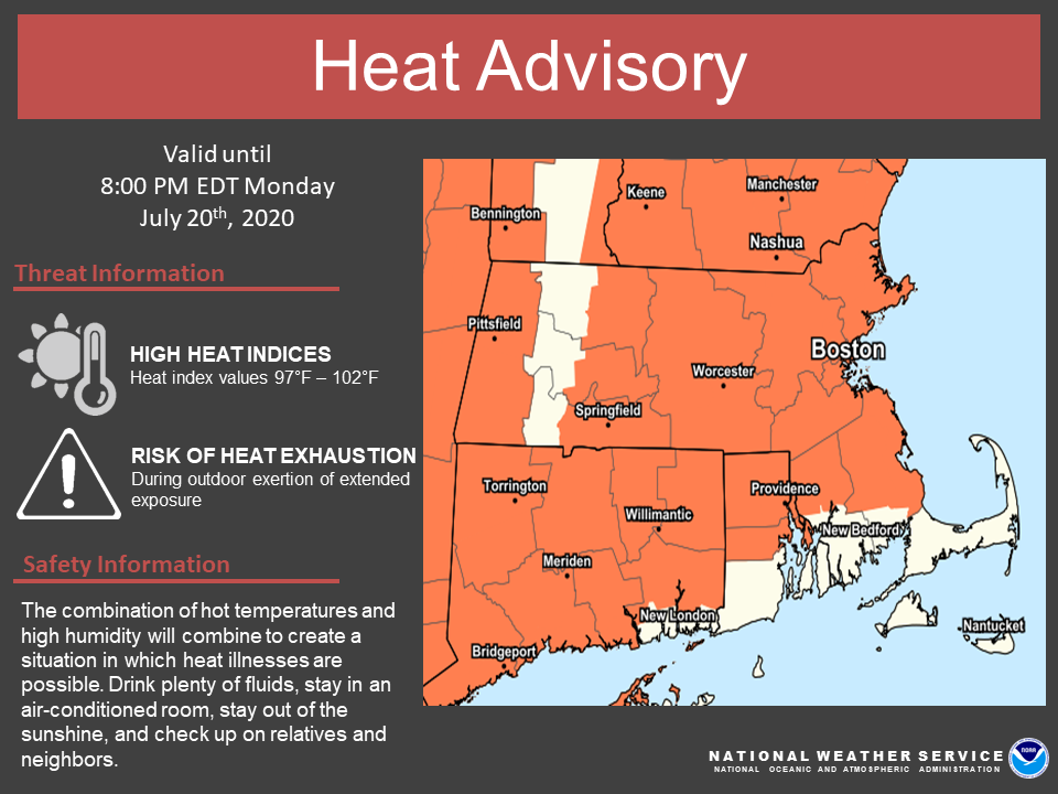
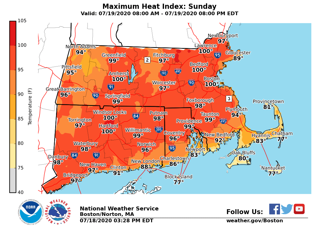
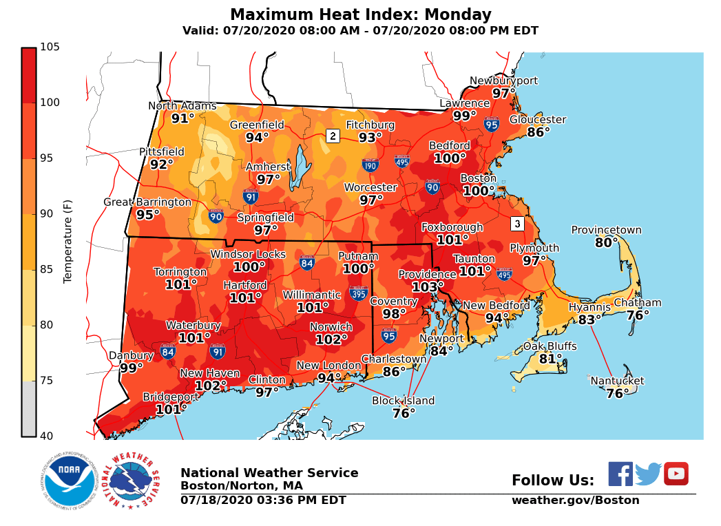
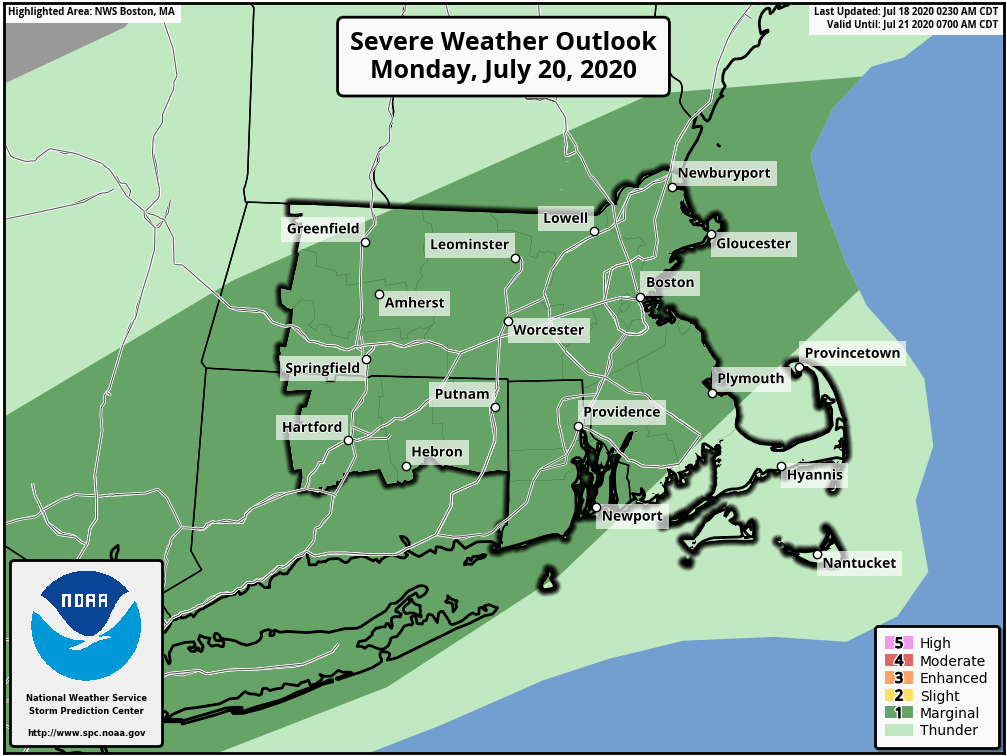
Good afternoon everyone, Following is an update to the briefing sent this morning based on Saturday afternoon's updated forecast. *What Has Changed:* The Heat Advisory has been expanded to now include the remainder of Worcester County. *Heat Advisory Sunday & Monday - Details*: *What:* - Heat index of 97 to 102 degrees. *Where:* - Much of Massachusetts, Connecticut and Rhode Island, except the South Coast and the Berkshires. *When:* - Sunday and Monday. *Impacts:* - Heat illnesses may occur with prolonged strenuous activity outdoors. *Scattered Thunderstorms Monday - Details:* Scattered strong thunderstorms are expected Monday afternoon. A few stronger storms may contain damaging wind gusts and heavy rainfall. Heavy rainfall may produce localized flooding. Attached are the updated Heat Advisory map and maximum heat index values forecast for Sunday and Monday. The Severe Thunderstorm Outlook for Monday is attached as well but is *unchanged* from this morning's briefing. Thank You! Meteorologists: Andrew Loconto and Bill Babcock If you have any questions or would like more information, don't hesitate to contact us via this email address, on NWSChat <https://nwschat.weather.gov/>, or at the following: National Weather Service Boston/Norton, MA 46 Commerce Way Norton, MA 02766 508.622.3280 Website <http://www.weather.gov/boston> | Facebook <http://www.facebook.com/NWSBoston> | Twitter <http://www.twitter.com/NWSBoston>
participants (1)
-
 BOX Operations - NOAA Service Account