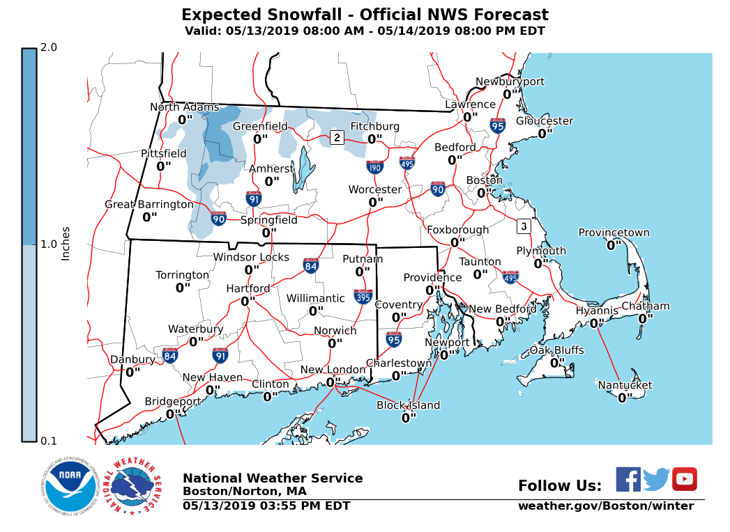
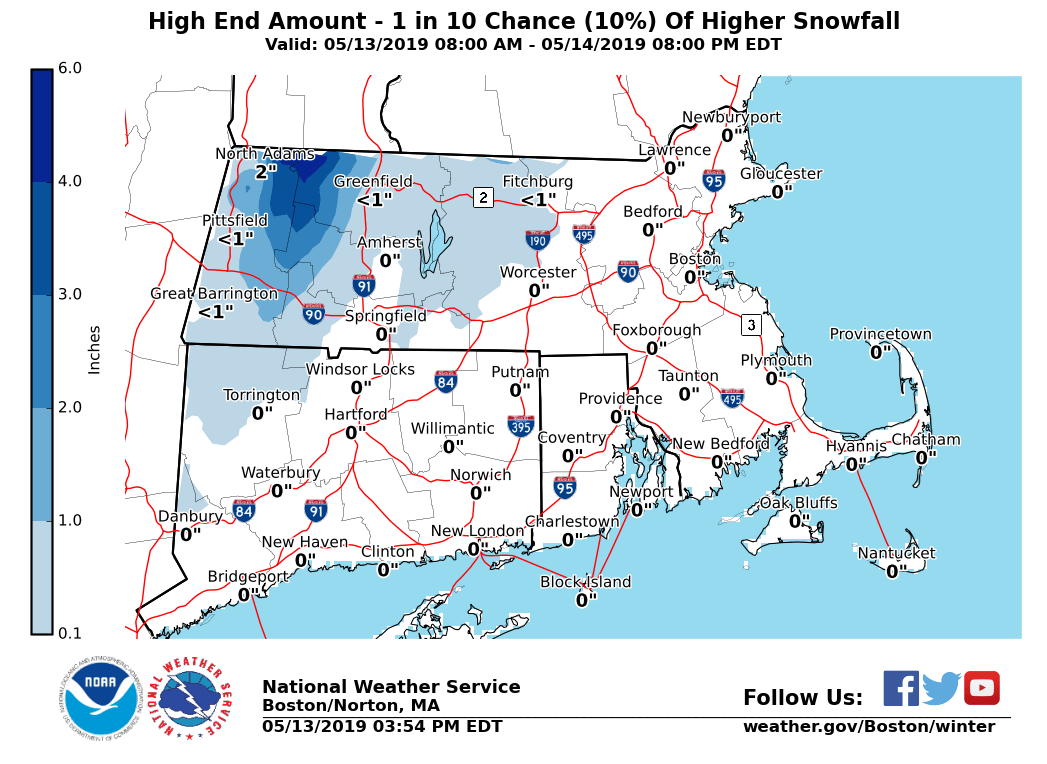
[2019.05.13 PM] Light Snow Possible Across Higher Terrain

Good afternoon, Our wet weather pattern will continue tonight into Tuesday morning. Temperatures will be low enough to support some wet snow mixing in with rain across the highest terrain towards the Berkshires as early as between 8-10 PM this evening. Snow will become more likely between midnight and 6 AM Tuesday. Any lingering snow should transition to all rain by 9 AM. Light snow accumulations are possible as low as 1,000 feet of elevation, but are most likely from 1,500 feet or higher. We have attached the most likely and reasonable worst-case scenario snowfall accumulations. Matthew Belk If you have any questions or would like more information, don't hesitate to contact us via this email address, on NWSChat <https://nwschat.weather.gov/>, or at the following: National Weather Service Boston/Norton, MA 46 Commerce Way Norton, MA 02766 508.622.3280 Website <http://www.weather.gov/boston> | Facebook <http://www.facebook.com/NWSBoston> | Twitter <http://www.twitter.com/NWSBoston>
participants (1)
-
 BOX Operations - NOAA Service Account