[2024.02.27 PM] Strong to Damaging Winds Likely Late Wed into Thu

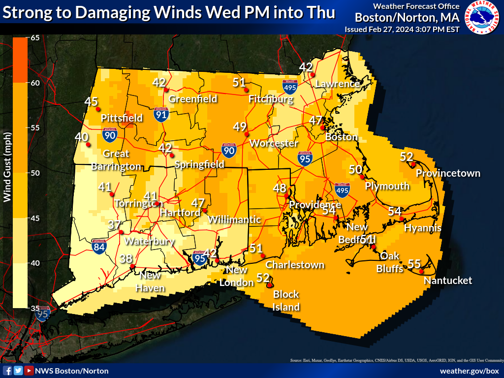
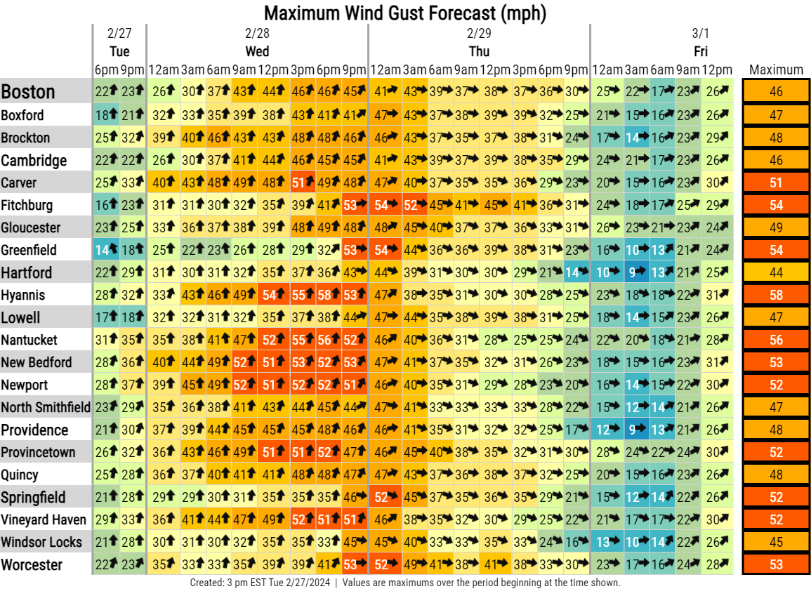
Good afternoon, Attached is our latest weather briefing. *What has changed:* - High Wind Warning in effect for Cape Cod and the islands - High Wind Watch has been expanded into northern Worcester county - Wind Advisory expanded into all of northern CT, including Hartford county - Wind Advisory expanded from southern Worcester, Middlesex & Essex counties Two surges of very strong to damaging winds remain in the forecast. The first surge will be Wednesday afternoon into early evening, with very strong to damaging south winds. The second surge of wind will occur later Wednesday evening into Thursday morning, with strong to damaging northwest winds. The long duration of south winds may enhance the wind damage potential across Cape Cod and the islands. Hence, the upgrade to a High Wind Warning for those locations. Heavy windswept rain will likely cause hazardous travel Wednesday night. Rain briefly turns to snow, as temperatures crash into the 30s and 20s behind the cold front Wednesday night. Any snow accumulations will be less than an inch, except 1-2" possible in the Berkshires. However, subfreezing temperatures combined with any residual/leftover road moisture, may yield slippery travel Wednesday night into Thursday morning. Kevin Cadima, Bill Leatham & Frank Nocera If you have any questions or would like more information, please don't hesitate to contact us. You can reach us via: email: box.operations@noaa.gov phone: 508.622.3280 Slack/NWSChat 2.0 <https://nwschatws.slack.com/> (for approved partners) social media: Website <http://www.weather.gov/boston> | Facebook <http://www.facebook.com/NWSBoston> | Twitter <http://www.twitter.com/NWSBoston>
participants (1)
-
 BOX Operations - NOAA Service Account