[2024.02.26 AM] Strong to Damaging Winds Possible Late Wed into Thu

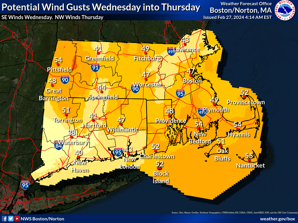
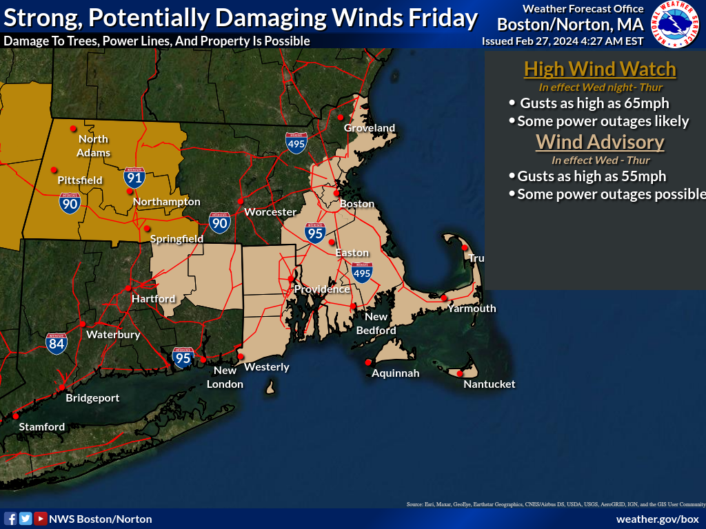
Good morning, Forecast confidence continues to grow in a strong to damaging wind event to occur in southern New England Wednesday through Thursday. A Wind Advisory is in effect for the I-95 corridor in Massachuests and Rhode Island, Cape Cod and the Islands, and NE Connecticut. A High Wind Watch is in effect for the Berkshires. We still anticipate two surges of wind. The first surge will be Wednesday afternoon to evening with strong south winds. The second surge of wind will occur overnight Wednesday into Thursday morning with strong to damaging northwest winds. Heavy windswept rain will likely cause hazardous travel Wednesday night. Rain briefly turns to snow as temperatures come crashing into the 20s behind the cold front. Not expecting snow accumulations at this time. Kyle Pederson and Matthew Belk If you have any questions or would like more information, please don't hesitate to contact us. You can reach us via: email: box.operations@noaa.gov phone: 508.622.3280 Slack/NWSChat 2.0 <https://nwschatws.slack.com/> (for approved partners) social media: Website <http://www.weather.gov/boston> | Facebook <http://www.facebook.com/NWSBoston> | Twitter <http://www.twitter.com/NWSBoston>
participants (1)
-
 BOX Operations - NOAA Service Account