[2025.11.05 PM] NWS Boston/Norton EM Briefing: Damaging Wind Gusts Late Tonight into early Thursday morning

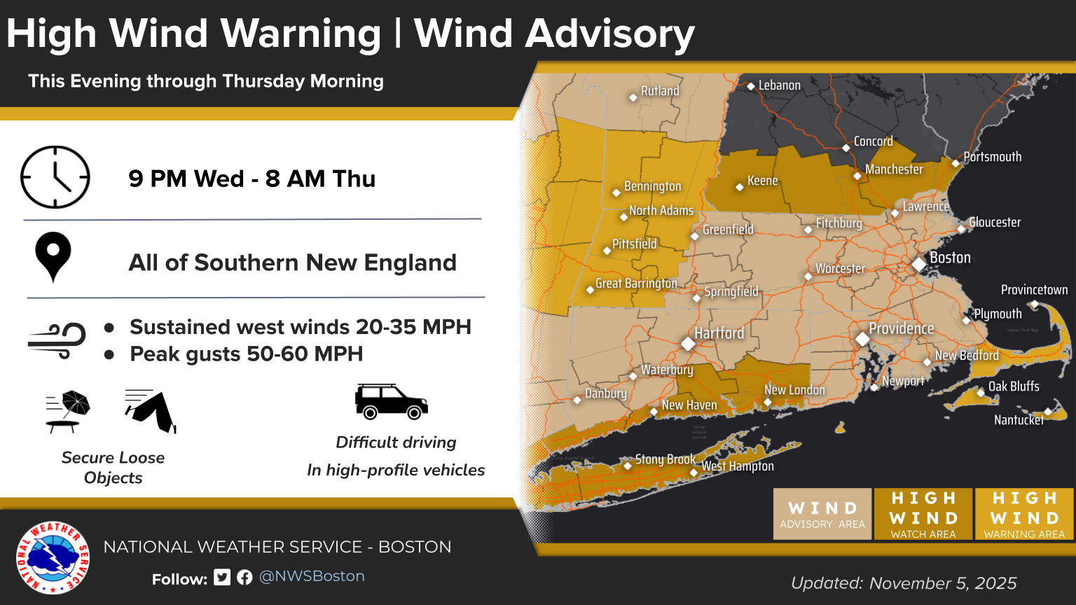
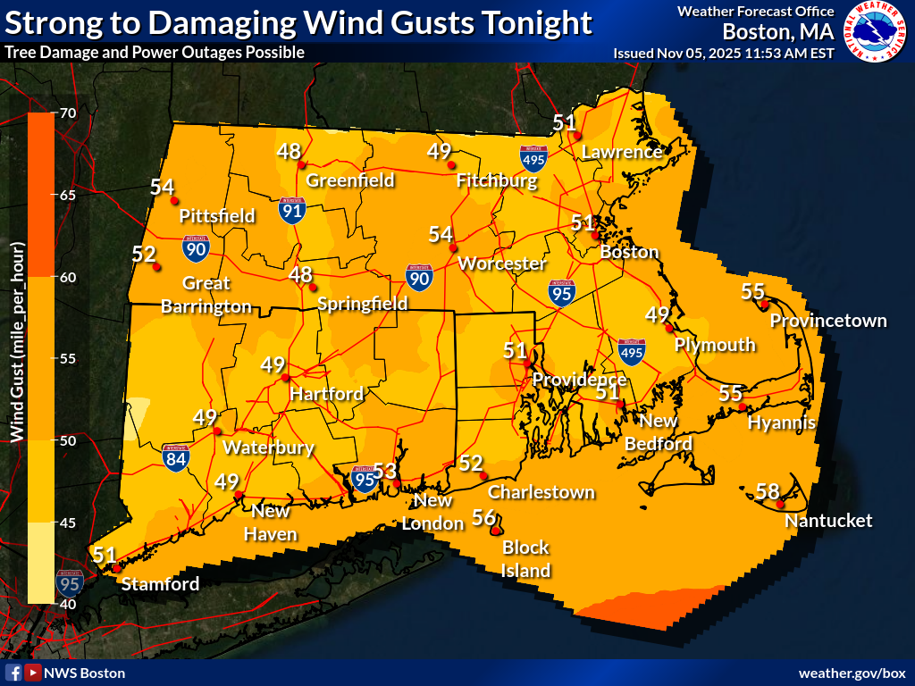
Good afternoon, Attached is our final briefing and supplemental graphics regarding the expected strong to damaging wind gusts across southern New England tonight. Since our last briefing, the High Wind Watch has been upgraded to a High Wind Warning for the Berkshires, Cape Cod, and the islands. Areas in between have been converted to a Wind Advisory. A strong cold front will sweep across southern New England late this evening, bringing showers and possible rumbles of thunder. Gusts within this line may approach severe criteria. However, the strongest winds are expected behind the cold front, with gusts of 50 to 60 mph. Localized higher gusts are possible in high-terrain areas, Cape Cod, and the islands. Behind the front, it will become cold with high temperatures Thursday in the 40s and lower 50s, followed by overnight temperatures Thursday night in the 20s and lower 30s. Thank you, Kevin Cadima, Andrew Loconto, and Torry Dooley If you have any questions or would like more information, please don't hesitate to contact us. You can reach us via: email: box.operations@noaa.gov phone: 508.622.3280 Slack/NWSChat 2.0 <https://nwschatws.slack.com/> (for approved partners) social media: Website <http://www.weather.gov/boston> | Facebook <http://www.facebook.com/NWSBoston> | Twitter <http://www.twitter.com/NWSBoston>
participants (1)
-
 BOX Operations - NOAA Service Account