[2025.11.04 PM] NWS Boston/Norton EM Briefing: Damaging WInd Gusts Late Wednesday night into early Thursday morning

Good afternoon everyone... High Wind Watches have been expanded into the Berkshires of Massachusetts as well as the rest of Connecticut for later Wednesday night into early Thursday morning. Westerly wind gusts of 55-65 mph are expected...which will result in some tree damage and power outages. Attached are graphics displaying the High Wind Watch, the maximum expected wind gusts, and a brief one-pager. Please let us know if you have any questions or concerns. Meteorologists: Hayden Frank, Kevin Cadima, Torry Dooley, and Candice Hrencecin If you have any questions or would like more information, please don't hesitate to contact us. You can reach us via: email: box.operations@noaa.gov phone: 508.622.3280 Slack/NWSChat 2.0 <https://nwschatws.slack.com/> (for approved partners) social media: Website <http://www.weather.gov/boston> | Facebook <http://www.facebook.com/NWSBoston> | Twitter
Good morning, This is a quick update to inform you that the High Wind Watch has been upgraded to a High Wind Warning for the Berkshires, Cape Cod, and the Islands. The High Wind Watch remains in effect for all other areas. We anticipate sending a final storm update and briefing around noon today. Thank you, NWS Boston/Norton If you have any questions or would like more information, please don't hesitate to contact us. You can reach us via: email: box.operations@noaa.gov phone: 508.622.3280 Slack/NWSChat 2.0 <https://nwschatws.slack.com/> (for approved partners) social media: Website <http://www.weather.gov/boston> | Facebook <http://www.facebook.com/NWSBoston> | Twitter <http://www.twitter.com/NWSBoston> On Tue, Nov 4, 2025 at 1:29 PM BOX Operations - NOAA Service Account < box.operations@noaa.gov> wrote:
Good afternoon everyone...
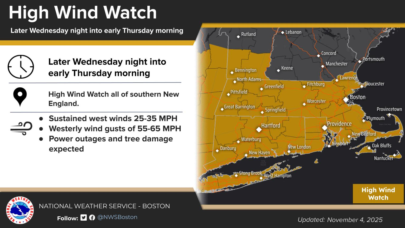
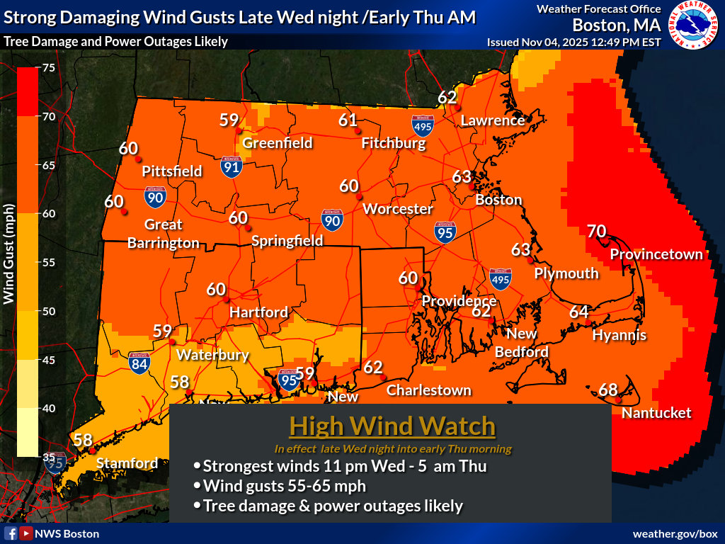
High Wind Watches have been expanded into the Berkshires of Massachusetts as well as the rest of Connecticut for later Wednesday night into early Thursday morning. Westerly wind gusts of 55-65 mph are expected...which will result in some tree damage and power outages.
Attached are graphics displaying the High Wind Watch, the maximum expected wind gusts, and a brief one-pager.
Please let us know if you have any questions or concerns.
Meteorologists: Hayden Frank, Kevin Cadima, Torry Dooley, and Candice Hrencecin
If you have any questions or would like more information, please don't hesitate to contact us. You can reach us via: email: box.operations@noaa.gov phone: 508.622.3280 Slack/NWSChat 2.0 <https://nwschatws.slack.com/> (for approved partners) social media: Website <http://www.weather.gov/boston> | Facebook <http://www.facebook.com/NWSBoston> | Twitter
participants (1)
-
 BOX Operations - NOAA Service Account