[2019.02.27 PM] Plowable Snow Tonight Into Early Thursday Morning

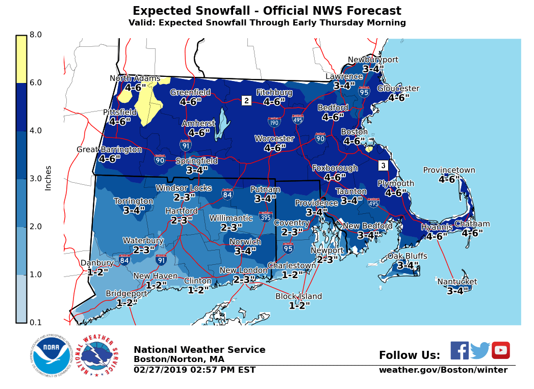
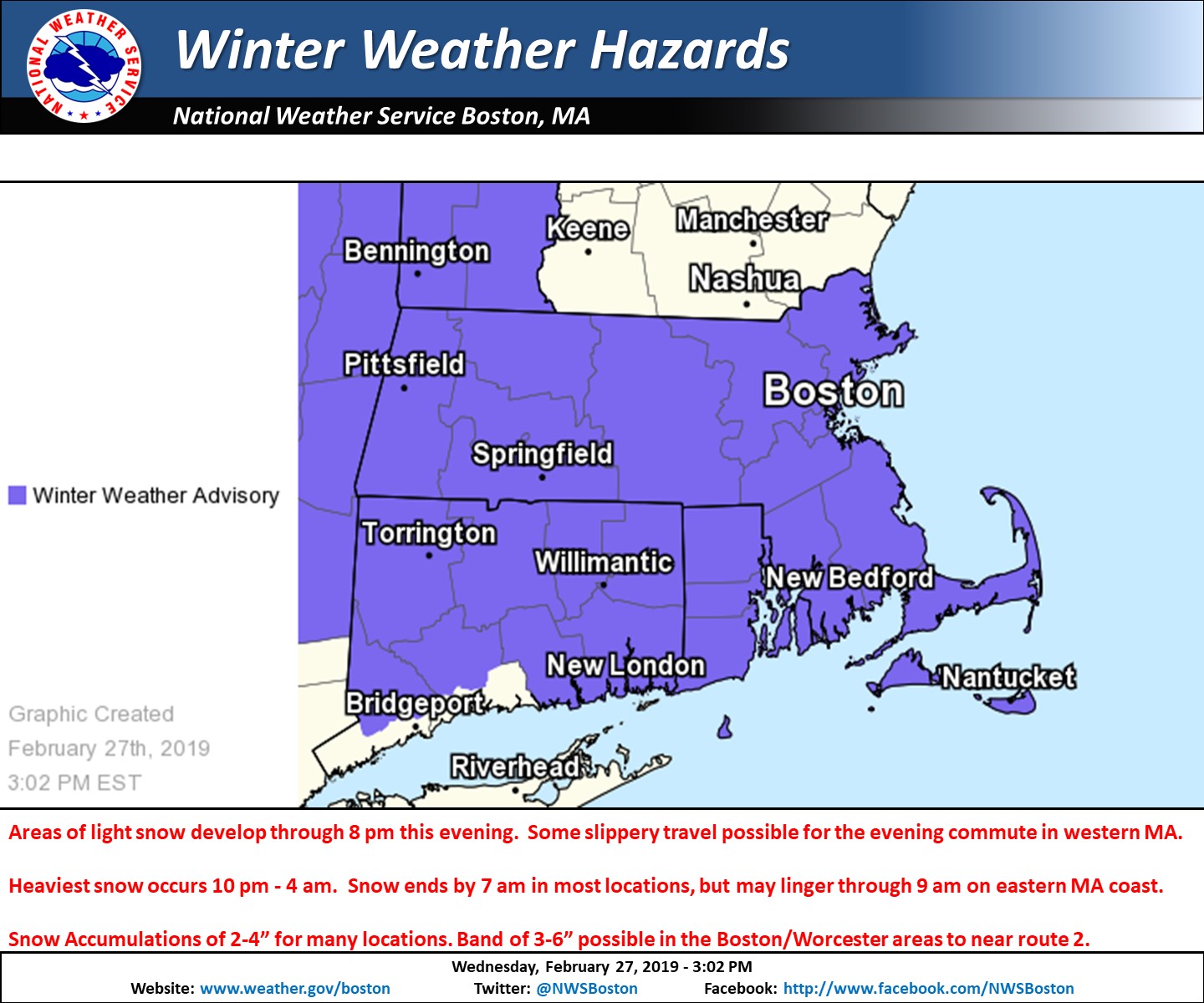
Good afternoon everyone Not too many changes from the previous thinking. We will attach images of our Winter Weather Headlines along with our latest snowfall forecast and included a brief outline below. - Areas of light snow develop through 5 or 6 pm in western MA, resulting in slippery travel for part of the evening commute especially near the Berkshires. - Light snow overspreads the rest of the region between 5 and 8 pm from west to east. - Steadiest snow occurs between 10 pm and 4 am, but snowfall rates will generally be less than 1 inch per hour. - Snow ends between 4 am and 7 am Thursday in most locations, but some light snow may linger through 9 or 10 am along the eastern MA coast. - Snow Accumulations of 2-4” for many, but it is possible that areas from near Hartford CT to coastal RI only receive an inch or two. A heavier band of 3-6” of snow is possible roughly 20 miles north or south of the MA Turnpike. This includes the Berks as well as the Boston to Worcester metro areas. - Although the snow will be over in most locales by the Thursday am rush hour, cold temperatures will result in some roads being snow covered/slippery for the morning commute. - This will be a dry snow event even along the coast. Please let us know if you have any questions or concerns. Thank You Meteorologist: Hayden Frank If you have any questions or would like more information, don't hesitate to contact us via this email address, on NWSChat <https://nwschat.weather.gov/>, or at the following: National Weather Service Boston/Norton, MA 46 Commerce Way Norton, MA 02766 508.622.3280 Website <http://www.weather.gov/boston> | Facebook <http://www.facebook.com/NWSBoston> | Twitter <http://www.twitter.com/NWSBoston>
participants (1)
-
 BOX Operations - NOAA Service Account