
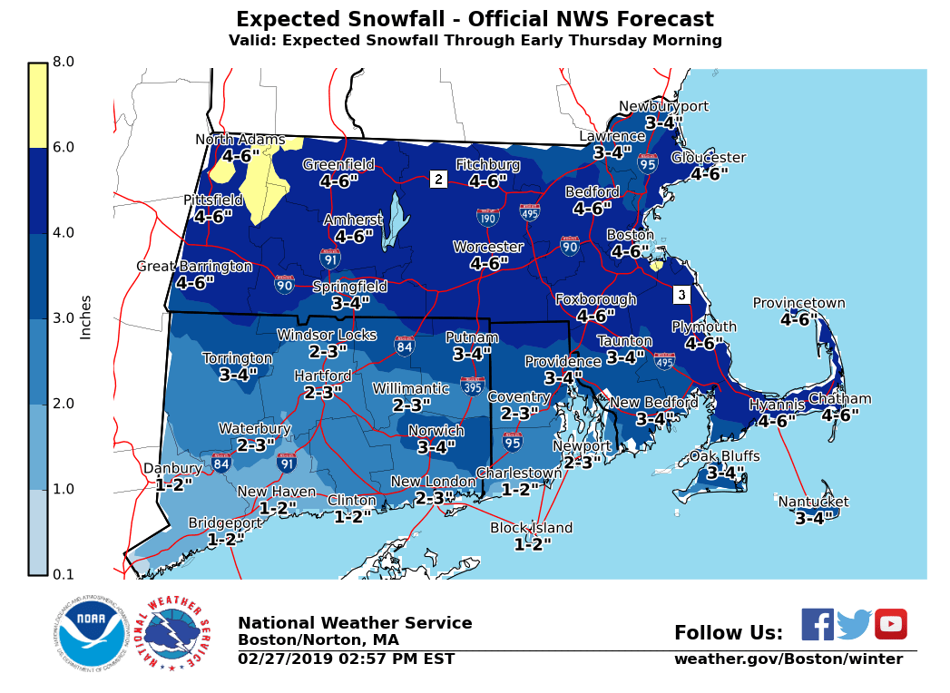
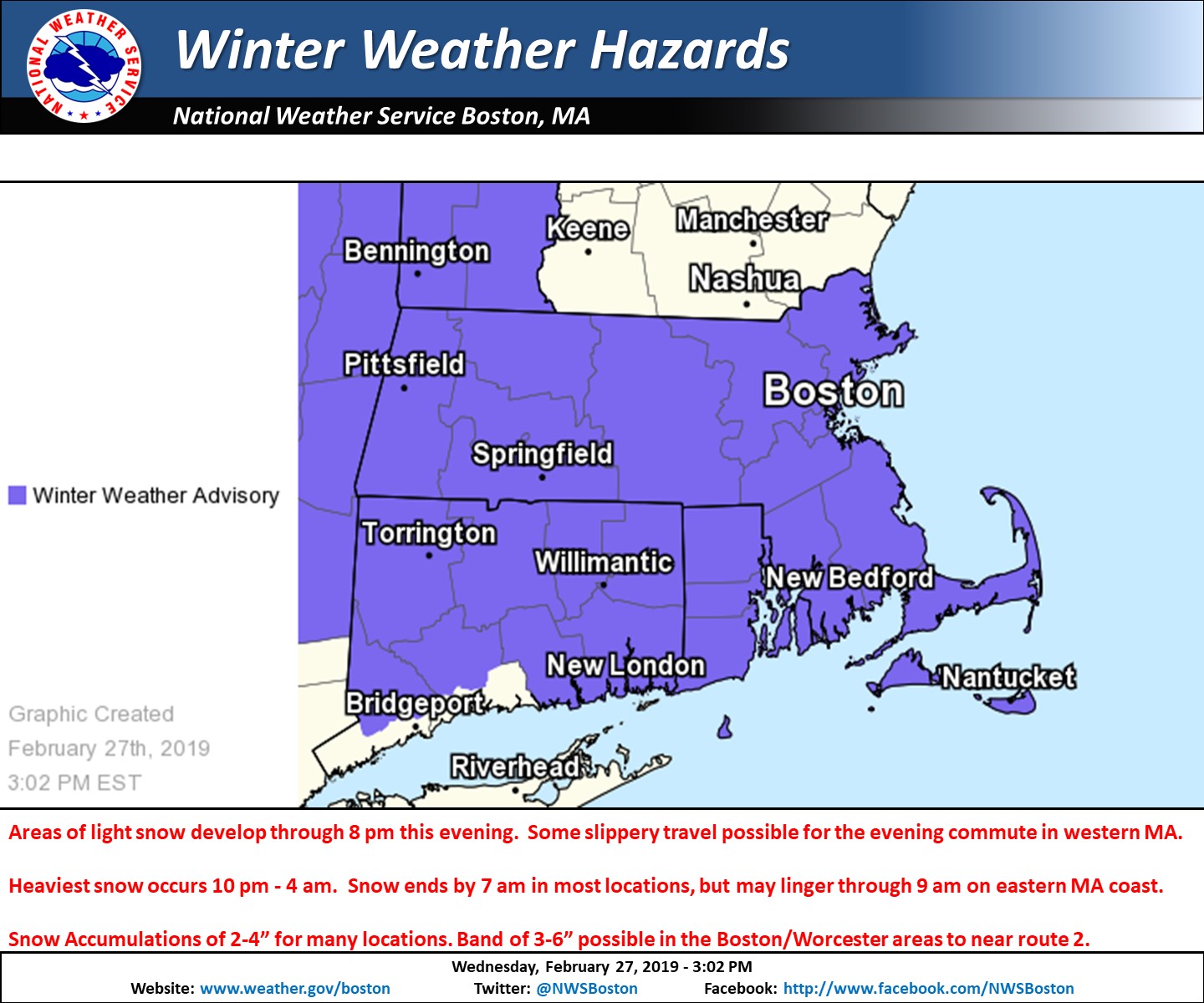
Good afternoon everyone Not too many changes from the previous thinking. We will attach images of our Winter Weather Headlines along with our latest snowfall forecast and included a brief outline below. - Areas of light snow develop through 5 or 6 pm in western MA, resulting in slippery travel for part of the evening commute especially near the Berkshires. - Light snow overspreads the rest of the region between 5 and 8 pm from west to east. - Steadiest snow occurs between 10 pm and 4 am, but snowfall rates will generally be less than 1 inch per hour. - Snow ends between 4 am and 7 am Thursday in most locations, but some light snow may linger through 9 or 10 am along the eastern MA coast. - Snow Accumulations of 2-4” for many, but it is possible that areas from near Hartford CT to coastal RI only receive an inch or two. A heavier band of 3-6” of snow is possible roughly 20 miles north or south of the MA Turnpike. This includes the Berks as well as the Boston to Worcester metro areas. - Although the snow will be over in most locales by the Thursday am rush hour, cold temperatures will result in some roads being snow covered/slippery for the morning commute. - This will be a dry snow event even along the coast. Please let us know if you have any questions or concerns. Thank You Meteorologist: Hayden Frank If you have any questions or would like more information, don't hesitate to contact us via this email address, on NWSChat <https://nwschat.weather.gov/>, or at the following: National Weather Service Boston/Norton, MA 46 Commerce Way Norton, MA 02766 508.622.3280 Website <http://www.weather.gov/boston> | Facebook <http://www.facebook.com/NWSBoston> | Twitter <http://www.twitter.com/NWSBoston>