
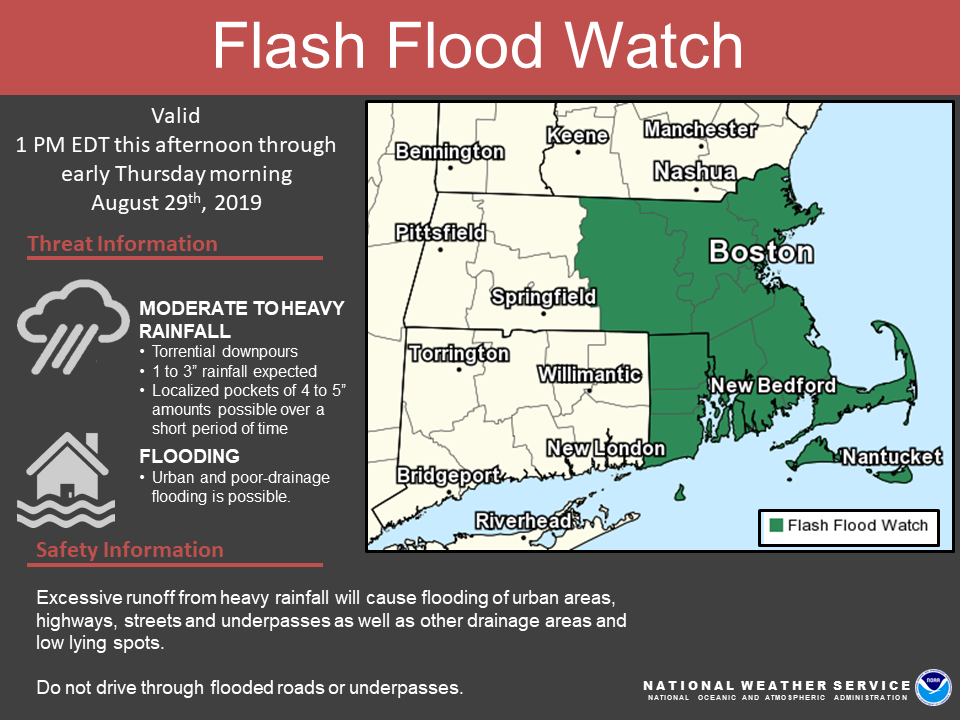
Good morning, Here are our latest thoughts on the potential for heavy rainfall later today which may lead to a risk of localized flash flooding. A* FLASH FLOOD WATCH* has been issued for central/eastern Massachusetts and Rhode Island. Details below. *What:* - Heavy rainfall with rainfall rates 1-2 inches/per hour - 1 to 3" of rainfall expected, with localized pockets of 4 to 5" over a short period of time - Urban and poor drainage flooding possible - *Concern for heavy rain/flooding during evening rush hour* - Low risk for an isolated severe storm *Where:* - All of southern New England, but a greater risk across eastern MA and RI *When:* - Wednesday afternoon through Wednesday night - The greatest risk will be Wednesday evening into the overnight hours *Uncertainty:* - The heaviest rainfall amounts and potential flooding will be localized and may occur anywhere across southern New England. However, the greatest confidence lies within the Flash Flood Watch area. Amounts will vary considerably over short distances. If you have any questions or would like more information, don't hesitate to contact us via this email address, on NWSChat <https://nwschat.weather.gov/>, or at the following: National Weather Service Boston/Norton, MA 46 Commerce Way Norton, MA 02766 508.622.3280 Website <http://www.weather.gov/boston> | Facebook <http://www.facebook.com/NWSBoston> | Twitter <http://www.twitter.com/NWSBoston>
participants (1)
-
 BOX Operations - NOAA Service Account