[2019.12.29 4 PM Update] NWS Boston EM Breifing: Severe Icing Threat & Wintry Mix Tonight-Monday Night

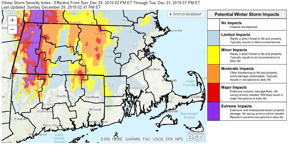
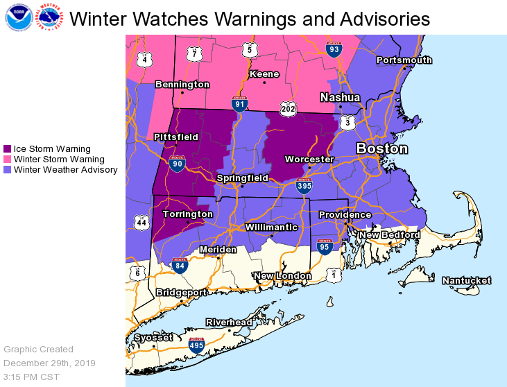
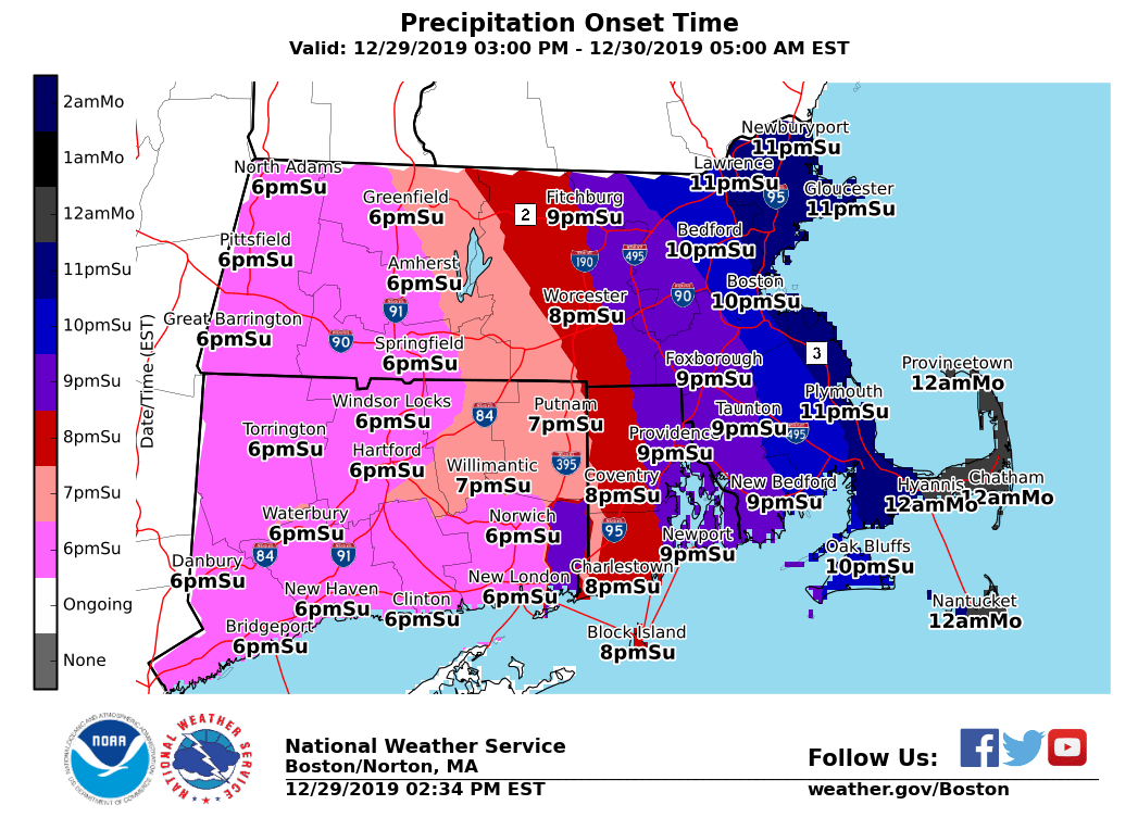
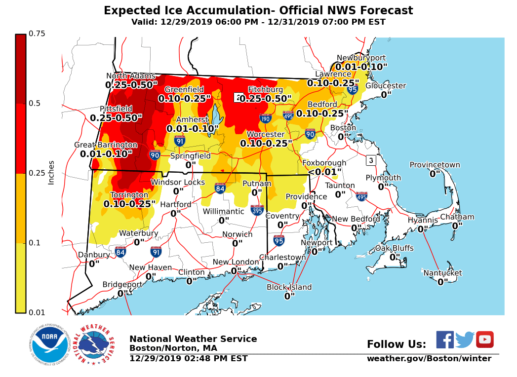
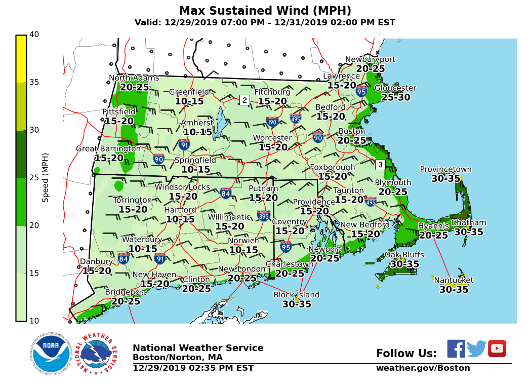
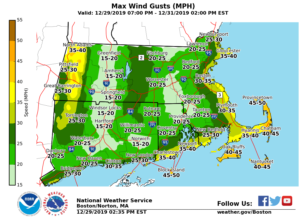
Good afternoon everyone, Here is the latest information on a storm that will impact Southern New England tonight into Tuesday. The greatest impacts are expected across the higher elevations of the slopes of the Berkshires, northern Worcester County and northwest Middlesex County. The graphics attached include the Winter Storm Severity Index (gives an idea where the worst impacts can be anticipated), storm total ice accumulations, current winter headlines, precipitation onset time, sustained wind speeds and peak gusts tonight into Monday afternoon (i.e. period when icing is greatest). *What has changed:* Winter Storm Warning changed to an Ice Storm Warning for northern Worcester County and northwest Middlesex County. In those areas we now expect one quarter to one half inch of ice with isolated totals to three quarters of an inch. *Current Watches/Warnings/Advisories in effect:* All warnings and advisories over land are in effect from tonight through Tuesday AM - *Ice Storm Warning **for the eastern slopes of the Berkshires, northern Worcester County and northwest Middlesex County.* Here is where the most significant icing is expected due to a long duration of freezing rain. Severe impacts can be expected with extensive power outages and tree damage. The Monday morning commute will be treacherous in those areas. - Winter Weather Advisory *for the rest of Southern New England except for southern RI, southern Plymouth & Bristol Counties in MA into Cape Cod and the Islands*. Mix of precipitation types for these areas. Expect lesser, but still impactful accretions of freezing rain and sleet. A slick Monday morning commute can be expected. *Marine Watches/Warnings in effect:* - *Gale Warnings* for all of the coastal waters except for Narragansett Bay. Starting Monday morning and continuing into early Tuesday. *Main Weather Concerns: * 1) *Severe icing across the higher elevations* *of* *western and north central MA tonight through Monday night*. Icing begins tonight and continues into Monday evening. For the slopes of the Berkshires we expect to have one half to three quarters of an inch of ice with isolated amounts up to one inch. In northern Worcester and northwest Middlesex Counties one quarter to one half inch of ice with isolated totals to three quarters of an inch. Easterly to northeasterly winds will increase throughout the day with gusts of 20-30 mph in the higher terrain by late afternoon. This, coupled with the ice, could worsen the impacts. By Tuesday temperatures increase into the upper 30s and low 40s in the higher terrain allowing for melting. 2)* Lower elevations: Lesser amounts of sleet and freezing rain tonight continuing through Monday. *Accumulations of freezing rain and sleet will impact the Monday morning commute. Across the MA East Coast, northernmost RI and CT a wintry mix is expected...changing to rain on Monday. Icing amounts range from a light glaze to one quarter inch. *Localized totals may be near a half-inch in spots northwest of I-84 and I-495 if freezing rain can remain more prolonged*. 3) *Strong east to northeast winds* are expected over the coastal waters and along the South Coast Monday night. Expect gusts of 40-45 mph across Cape Cod and the Islands Monday afternoon and evening. *What we are uncertain about:* *Moderate confidence:* - Uncertain on the duration and exact precipitation type outside of the Ice Storm Warning areas. If colder air lingers longer than currently forecast then this may result in a change to sleet and ice accumulations. The risk for this is highest across northeast MA, southern interior MA and into northern CT. - Monitoring the potential for higher ice accumulations across southern Worcester County and for extreme northwest Hartford County (Hartland). Meteorologists: Nicole Belk, Bill Babcock, Glenn Field and Bill Leatham If you have any questions or would like more information, don't hesitate to contact us via this email address, on NWSChat <https://nwschat.weather.gov/>, or at the following: National Weather Service Boston/Norton, MA 46 Commerce Way Norton, MA 02766 508.622.3280 Website <http://www.weather.gov/boston> | Facebook <http://www.facebook.com/NWSBoston> | Twitter <http://www.twitter.com/NWSBoston>
participants (1)
-
 BOX Operations - NOAA Service Account