NWS Albany - Wind Advisory and Winter Weather Potential - Issued 430 PM Sunday, December 15th

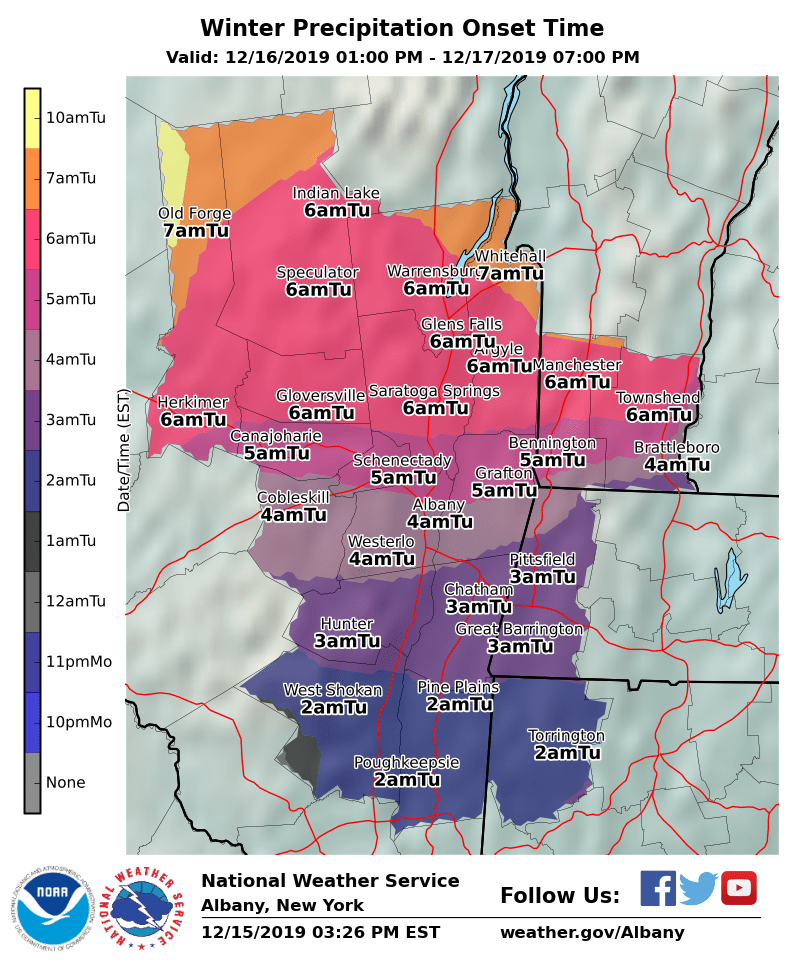
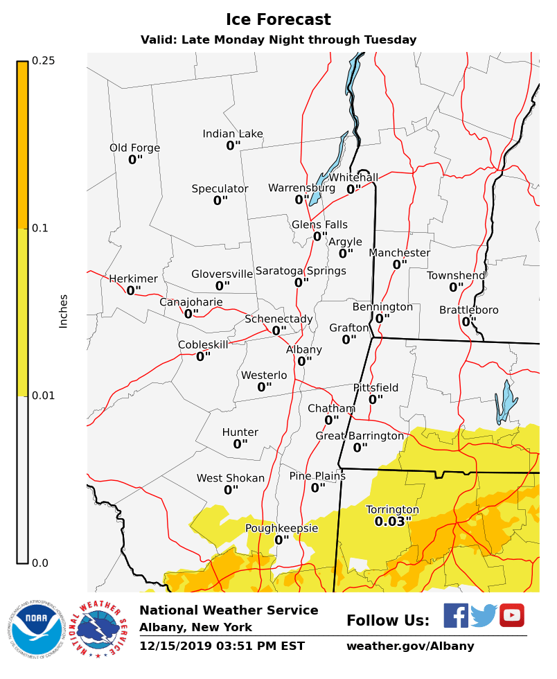
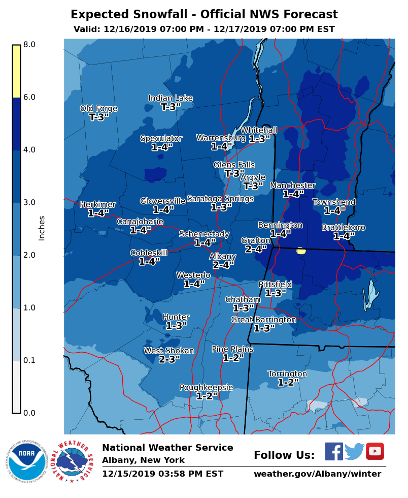
**** The information in this email pertains to the following areas only:**** *- In Connecticut: Litchfield County* *- In Massachusetts: Berkshire County* *- In Vermont: Bennington & Windham Counties* *- In New York: Albany, Columbia, Dutchess, Fulton, Hamilton, Herkimer, Montgomery, Greene, Rensselaer, Saratoga, Schenectady, Schoharie, Ulster, Warren and Washington Counties* Dear Emergency Managers and other partners, Several weather hazards are possible through the week. - A Wind Advisory remains in effect for portions of eastern New York and western New England through 7 PM today for the potential for 50 mph winds resulting in downed tree limbs and scattered power outages. - A storm system is expected to bring snow and a wintry mix to the region late Monday night into Tuesday. The best chance at seeing a wintry mix is south of Albany, with mostly snow favored from Albany north. Light to moderate accumulations of snow, sleet, and ice are possible, which could lead to difficult travel conditions. Winter weather advisories may be needed in some areas. - Snow squalls are possible on Wednesday, which could result in rapid changes in visibility and difficult travel conditions. - Bitter cold temperatures are possible Wednesday night through the end of the work week. Wind Chill Advisories may be needed for parts of the area. Please refer to the attached images for details. If you have any questions, please feel free to contact us via: 1. Email: alb.stormreport@noaa.gov 2. NWSChat at https://nwschat.weather.gov/live/ 3. Social Media: Facebook <https://www.facebook.com/NWSAlbany> and Twitter <https://twitter.com/NWSAlbany> 4. Telephone: (518) 435-9575 <518-435-9575> Sincerely, NWS Albany www.weather.gov/albany
participants (1)
-
 ALB Stormreport - NOAA Service Account