
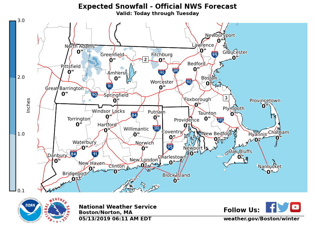
Good morning, Rain will move into Southern New England this afternoon and continue through Tuesday. The air above the ground will be cold enough to bring a mix of rain and wet snow. Accumulating snow is possible, but mainly at elevations above 1500 feet MSL. An inch or two is possible at these levels. - As displayed in the attached map, the areas most likely to be affected are in the East Slopes of the Berkshires and the northern Worcester Hills. - The most likely time of occurrence is 8 PM to 8 AM tonight and Tuesday morning. If you have any questions or would like more information, don't hesitate to contact us via this email address, on NWSChat <https://nwschat.weather.gov/>, or at the following: National Weather Service Boston/Norton, MA 46 Commerce Way Norton, MA 02766 508.622.3280 Website <http://www.weather.gov/boston> | Facebook <http://www.facebook.com/NWSBoston> | Twitter <http://www.twitter.com/NWSBoston>