
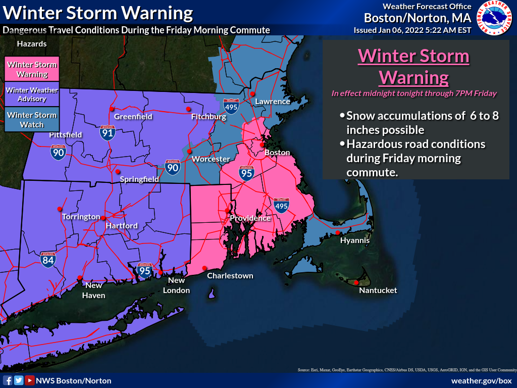
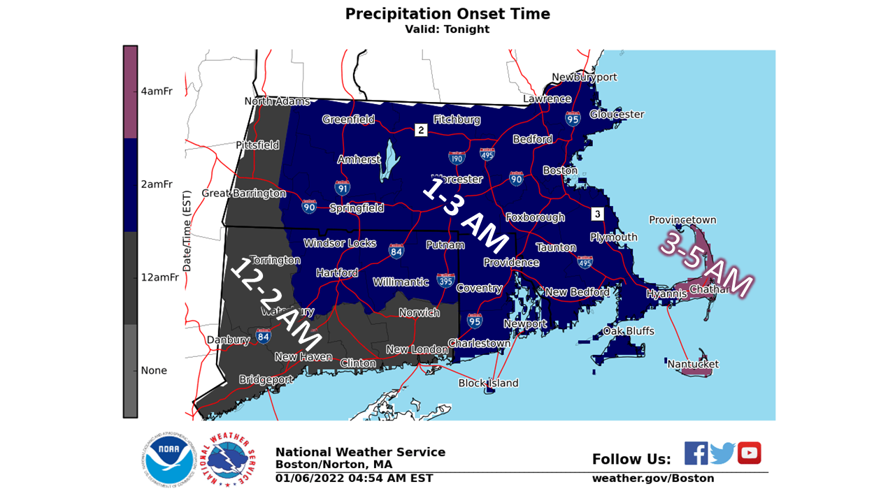
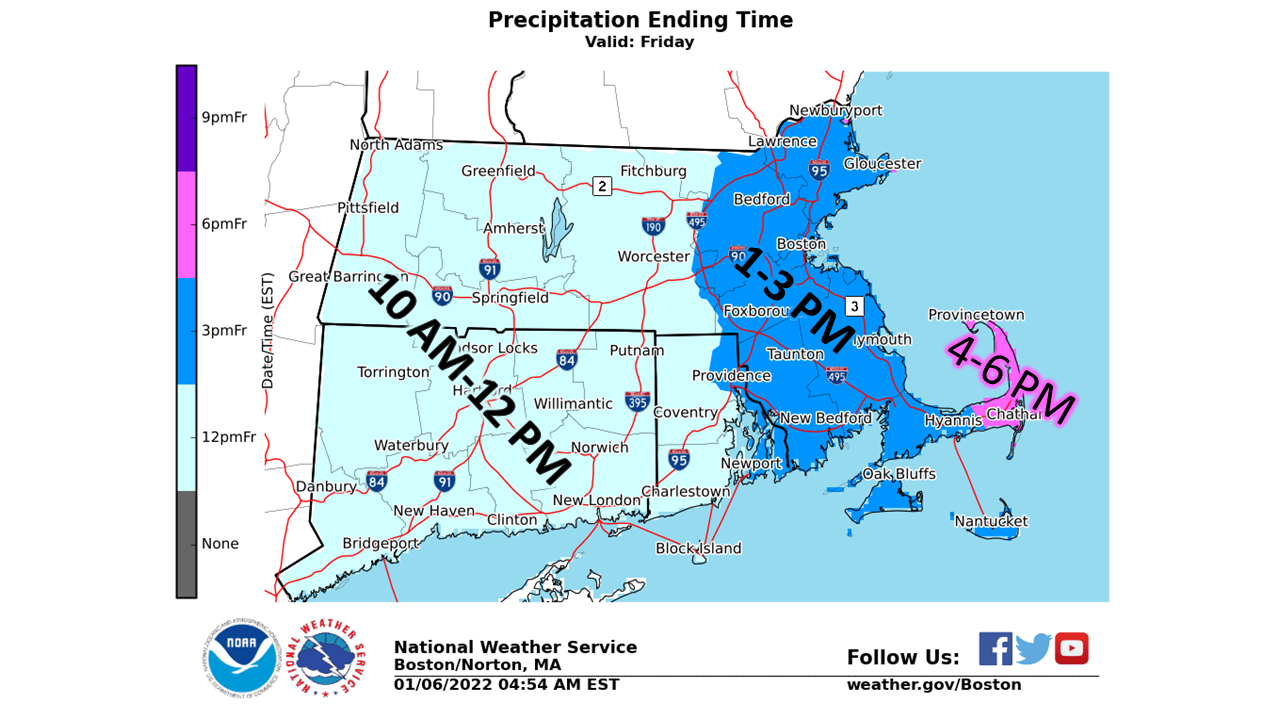
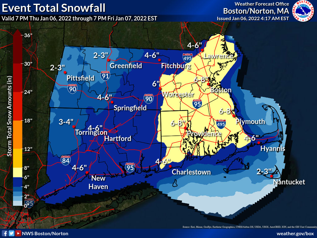
Good morning, Attached is an updated briefing regarding the winter storm tonight into Friday. The most substantial change compared to our earlier briefing is the issuance of a Winter Storm Warning and Winter Weather Advisories, where confidence is highest. Winter Storm Watches have been issued where there is the greatest uncertainty. These areas under a Watch are at risk for 6 inches or more of snowfall, but confidence is not yet high enough to issue a Warning. The potential for heaviest snowfall rates, greater than 1" per hour, looks to be centered along the I-95 corridor in MA and RI, southeast to near the Cape Cod Canal. Additional images from the briefing have been attached for your convenience. We also included a If you have any questions or would like more information, don't hesitate to contact us via this email address, on NWSChat <https://nwschat.weather.gov/>, or at the following: Matthew Belk and Rob Megnia National Weather Service Boston/Norton, MA 46 Commerce Way Norton, MA 02766 508.622.3280 Website <http://www.weather.gov/boston> | Facebook <http://www.facebook.com/NWSBoston> | Twitter <http://www.twitter.com/NWSBoston>