[2022.01.06 AM] NWS Boston EM Briefing - Winter Storm Tonight into Friday

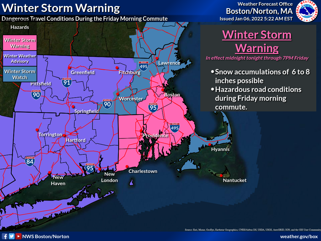
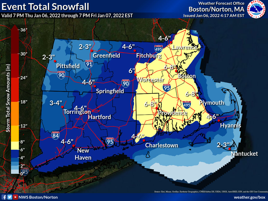
Good morning, Attached is an updated briefing regarding the winter storm tonight into Friday. The most substantial change compared to our earlier briefing is the issuance of a Winter Storm Warning and Winter Weather Advisories, where confidence is highest. Winter Storm Watches have been issued where there is the greatest uncertainty. These areas under a Watch are at risk for 6 inches or more of snowfall, but confidence is not yet high enough to issue a Warning. The potential for heaviest snowfall rates, greater than 1" per hour, looks to be centered along the I-95 corridor in MA and RI, southeast to near the Cape Cod Canal. Additional images from the briefing have been attached for your convenience. We also included a If you have any questions or would like more information, don't hesitate to contact us via this email address, on NWSChat <https://nwschat.weather.gov/>, or at the following: Matthew Belk and Rob Megnia National Weather Service Boston/Norton, MA 46 Commerce Way Norton, MA 02766 508.622.3280 Website <http://www.weather.gov/boston> | Facebook <http://www.facebook.com/NWSBoston> | Twitter <http://www.twitter.com/NWSBoston>
participants (1)
-
 BOX Operations - NOAA Service Account