[2022.01.06 AM] NWS Boston EM Briefing - *Additional Info* Winter Storm Tonight into Friday

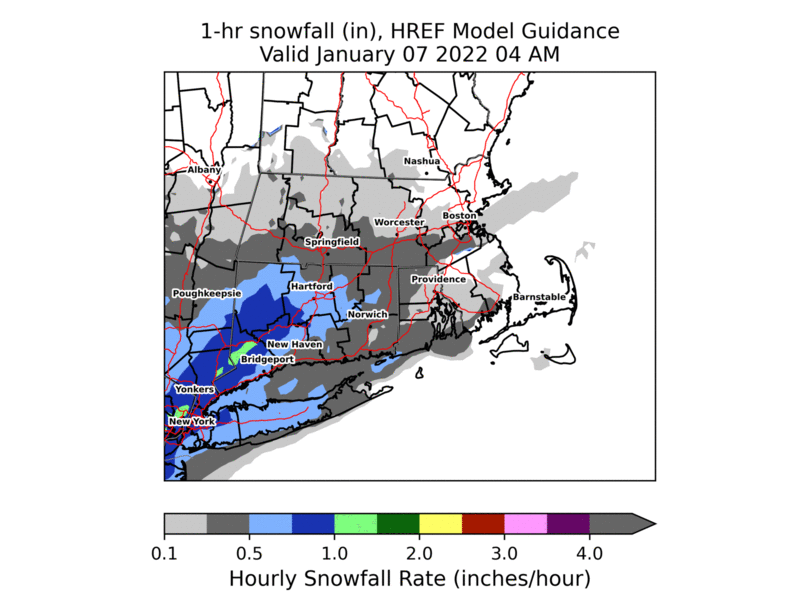
Good morning, Apologies for the previously unfinished email. To supplement the information provided in our previous email we've included on this email an animated loop of snowfall rates. This animation is model guidance and not the official forecast. It is meant to serve as a rough estimate as to when to expect the heaviest snowfall and where/when snowfall rates >1" per hour will be possible. Areas shaded in green represent snowfall rates >1 inch per hour. Thank you, Rob Megnia and Matthew Belk If you have any questions or would like more information, don't hesitate to contact us via this email address, on NWSChat <https://nwschat.weather.gov/>, or at the following: National Weather Service Boston/Norton, MA 46 Commerce Way Norton, MA 02766 508.622.3280 Website <http://www.weather.gov/boston> | Facebook <http://www.facebook.com/NWSBoston> | Twitter <http://www.twitter.com/NWSBoston>
participants (1)
-
 BOX Operations - NOAA Service Account